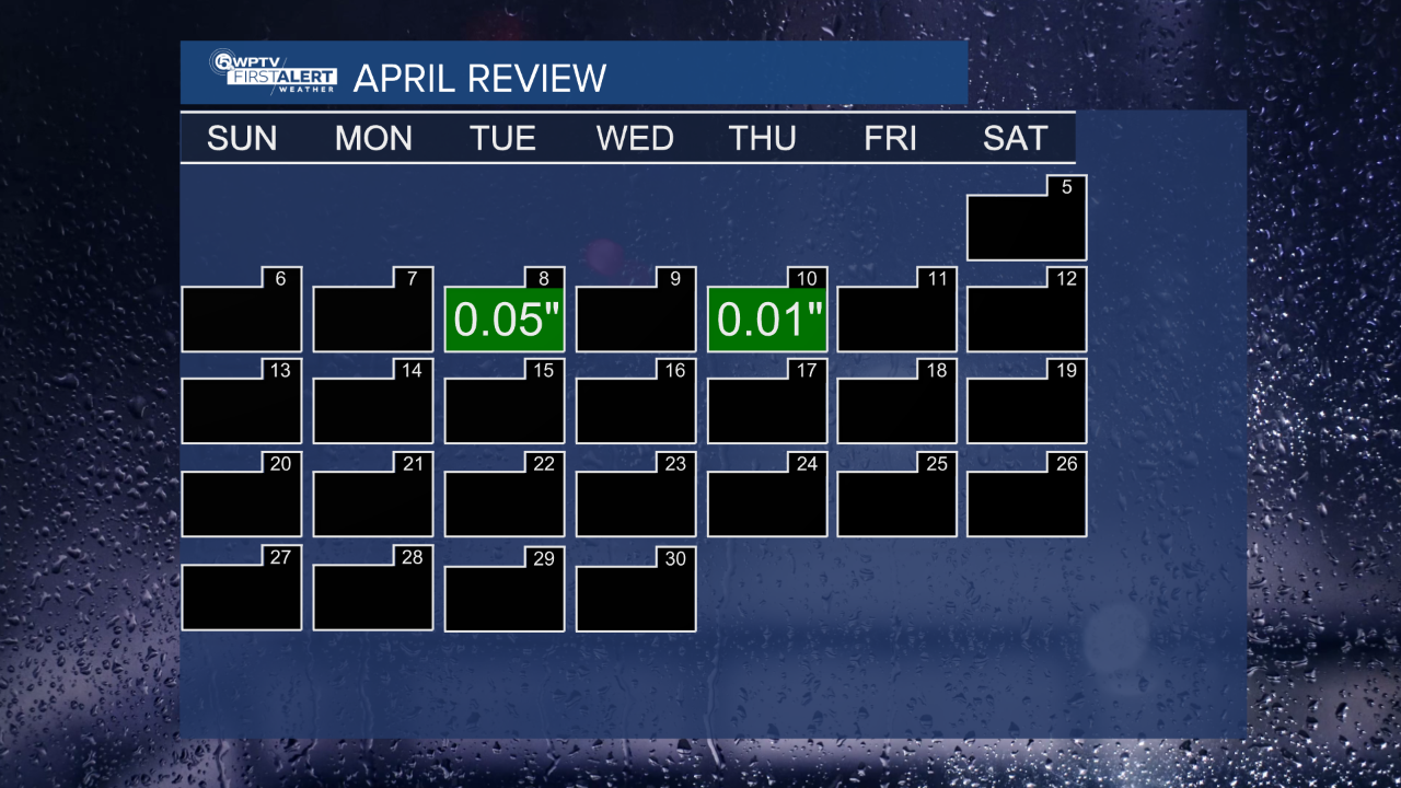
WEST PALM BEACH, Fla. — As we begin a new month, we had the fifth driest April on record, with only 0.06″ of rainfall recorded at Palm Beach International Airport.
wptv
Today, we will be tracking afternoon showers and storms across the area. Some will be strong to severe with damaging wind gusts as our main threat, and localized flooding.
WATCH WEATHER REPORT BELOW:
WPTV First Alert Morning Forecast – May 4th, 2025
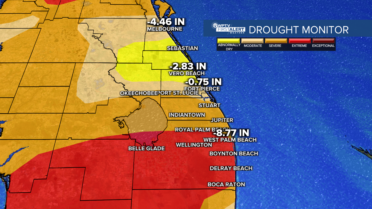
The scattered rain will move in after 2 p.m., something we desperately need due to extremely dry spots on the drought monitor.
Sunday high temperatures will be in the middle 80s with humidity.
wptv
MORE WEATHER: Radar | Alerts | 7-Day Forecast | Hourly Forecast
Monday will be warm and muggy with overcast skies. High temperatures stay in the mid-80s.
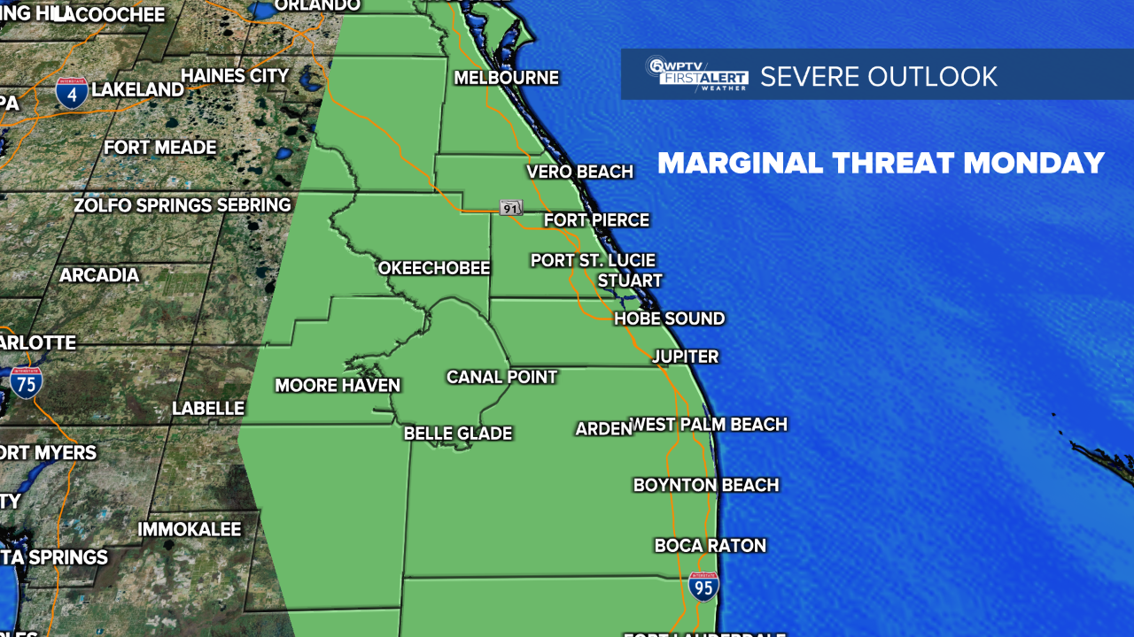
We will look for another round of showers to storms across the area on Monday afternoon into the evening. We are under a marginal threat for strong to severe storms again. Damaging wind gusts near 35+ mph will be our greatest concern.
wptv
Beyond the 2 days of storms, expect hot and very humid weather for most of the work week. This will be a hint of summertime.
Highs in the middle to upper 80s Tuesday through Friday with partly cloudy skies. Lows will be in the lower 70s. Unfortunately, there won’t be a sense of relief from the humidity anytime soon.


